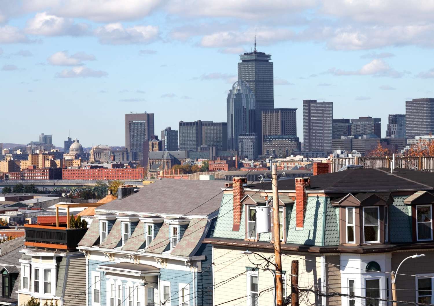
Boston’s Seaport District can feel, at first glance, like one of the city’s newest neighborhoods with its glassy towers, harbor-front restaurants, contemporary art, and wide pedestrian paths that catch the light off the water. But look more closely and the area begins to tell a much older story. This stretch of South Boston has long been tied to the harbor, from shipbuilding and maritime trade to fishing, warehousing, and the city’s evolving relationship with its working waterfront.
Today, the Seaport is one of Boston’s most striking examples of reinvention. Its industrial bones remain visible in Fort Point’s brick warehouses, the Boston Fish Pier, old wharf structures, and the rhythm of the harbor itself. Alongside them, visitors now find museums, public art, restaurants, parks, and some of the best waterfront walking in the city. For travelers who want to understand Boston beyond the Freedom Trail, the Seaport offers a different kind of historical lens: one shaped by commerce, labor, immigration, landmaking, climate, creativity, and the sea.
A visit here might begin beside the Fort Point Channel, follow the Harborwalk toward the Institute of Contemporary Art, pause for oysters or a lobster roll, and end with the skyline behind you and the harbor opening ahead. (Note, you might also want to check out our Boston walking tours.)
Start with the Boston Harborwalk
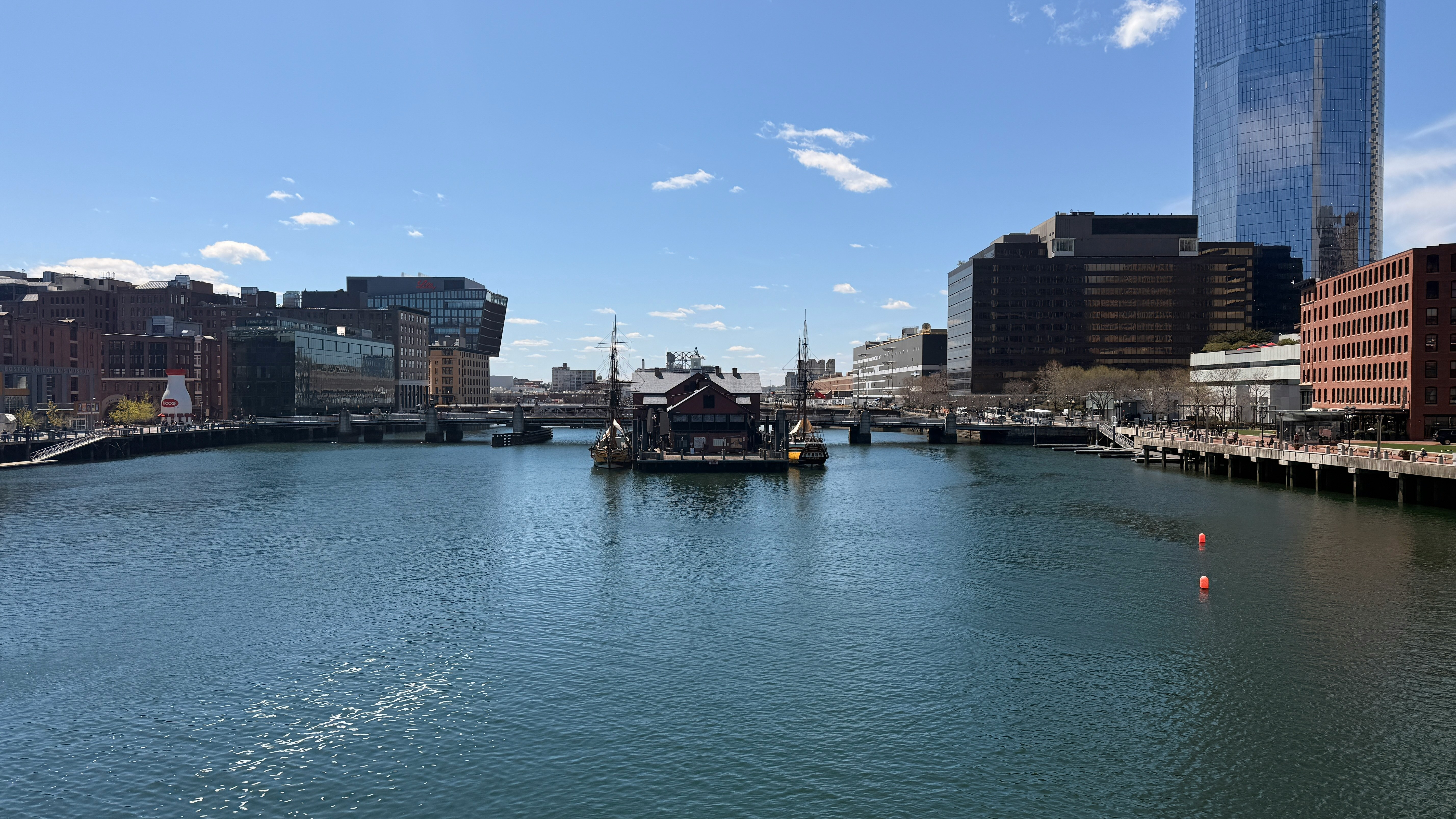
One of the best ways to explore the Seaport and South Boston waterfront is on foot. The Boston Harborwalk now stretches for roughly 43 miles along the city’s shoreline, connecting waterfront neighborhoods from East Boston and Charlestown to the North End, Downtown, Seaport, South Boston, and Dorchester. In the Seaport, it gives visitors an unusually direct way to read the city’s maritime past and present in sequence.
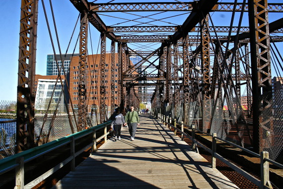
Begin near the Fort Point Channel, where the water still marks an important threshold between downtown Boston and the former industrial waterfront. The old Northern Avenue Bridge once offered one of the most atmospheric crossings into the Seaport, but travelers should note that it is no longer a pedestrian route. Closed for safety reasons and now subject to removal plans, it remains part of the neighborhood’s story rather than a practical way to enter it. Today, nearby crossings such as the Evelyn Moakley Bridge or the Seaport Boulevard and Congress Street bridges offer easier access.
From there, the Harborwalk opens into one of Boston’s most rewarding urban walks. The route is especially appealing in warm weather, when the breeze off the water softens the city’s pace. But it is also a useful way to understand how Boston’s edge has changed over time: from working wharves and industrial lots to a public waterfront designed for strolling, gathering, dining, and cultural life.
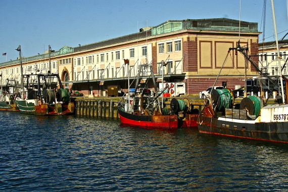
The Fish Pier and the Working Waterfront
The Seaport’s transformation has been dramatic, but it has not erased the neighborhood’s working identity entirely. The Boston Fish Pier, built in the early 20th century, remains one of the clearest links to the area’s maritime economy. It is not a polished tourist attraction in the conventional sense, and that is part of its value. It reminds visitors that the waterfront was never only scenic. It was functional, physical, and deeply tied to the labor of the city.
Seasonal public programming has also brought new energy to the area, including the Fish & Farm Market at the Boston Fish Pier, which brings together seafood, farm products, local vendors, and community programming during the warmer months.

For seafood nearby, James Hook & Co. remains a classic stop just across the channel, especially for lobster rolls and a casual waterfront-adjacent lunch. In the Seaport itself, Legal Sea Foods Harborside offers a more polished harbor-view experience, while restaurants in Fort Point and along the waterfront reflect how much the neighborhood’s dining scene has expanded. The key is to choose based on the mood of the day: casual lobster roll, oyster bar, rooftop drink, waterfront dinner, or a slower meal after a long walk.
Contemporary Art on the Water
The Institute of Contemporary Art is one of the Seaport’s defining cultural landmarks. Though the ICA was founded in 1936, its waterfront building gave the museum a powerful new presence in the city. Designed by Diller Scofidio + Renfro, the building makes the harbor part of the experience. Its galleries, public spaces, and views encourage visitors to think not only about the art on the walls, but also about the act of looking itself.
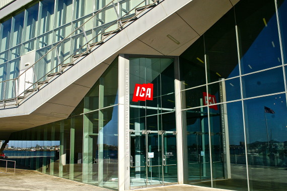
A visit to the ICA pairs especially well with a walk along the Harborwalk. The building’s relationship to the water is deliberate and memorable, and its exhibitions offer a contemporary counterpoint to Boston’s more familiar colonial and revolutionary narratives. Where much of the city asks visitors to look backward, the ICA invites them to consider the present moment: new forms, new questions, and new ways of seeing.
In summer, the ICA can also become a gateway to the harbor more broadly. The ICA Watershed, its seasonal space in East Boston, is typically open during the warmer months and connected by water shuttle for museum visitors. This makes the museum not just a destination, but part of a larger harbor experience—one that links art, transit, waterfront access, and the changing identity of Boston’s shoreline.
Fort Point: Warehouses, Artists, and Public Art
Just inland from the Seaport’s newer development, Fort Point offers a different texture. Its historic warehouse buildings, many associated with Boston’s industrial and shipping past, now hold offices, residences, studios, galleries, and creative spaces. This is one of the most important areas to include if you want the Seaport to feel layered rather than purely new.
Fort Point has long been associated with Boston’s arts community. The Fort Point Arts Community continues to support local artists, including through open studios, exhibitions, and advocacy for creative space in a neighborhood where real estate pressure has reshaped daily life. For visitors, this means the area can reward wandering. Look for public art, murals, small galleries, artist spaces, and the architectural rhythm of old brick warehouses against newer construction.
This part of the neighborhood also helps explain the Seaport’s tension. It is both a success story of urban redevelopment and a place where questions of access, affordability, preservation, and public space remain visible.
Families, History, and the Fort Point Channel
The Seaport is also one of Boston’s easiest waterfront neighborhoods for families. The Boston Children’s Museum sits along the Fort Point Channel, close to the Harborwalk and Martin’s Park. The museum is a major draw for younger travelers, while the surrounding waterfront gives families room to pause, play, and take in the city without rushing from landmark to landmark.
Martin’s Park, adjacent to the museum, is especially worth noting. Designed as an inclusive, climate-resilient public space, it offers a thoughtful example of how Boston is reimagining waterfront parks for both play and environmental awareness. Even for visitors without children, the park is a meaningful stop because it reflects the Seaport’s future-facing questions: How should a historic harbor city adapt its public spaces for changing climate realities? How can a waterfront be beautiful, accessible, and resilient at once?
Nearby, the Boston Tea Party Ships & Museum offers another entry point into the neighborhood’s historic landscape. Although many visitors associate Revolutionary Boston with the North End, Beacon Hill, and the Freedom Trail, the Fort Point Channel area also keeps alive the city’s revolutionary memory. For families or first-time visitors, it can help connect the Seaport’s waterfront setting to one of Boston’s most famous acts of protest.
When to Visit the Seaport
The Seaport is at its best when you can spend time outside. Late spring through early fall is ideal for the Harborwalk, patio dining, boat views, public art, and long golden-hour walks. Summer brings the clearest sense of the neighborhood as a waterfront destination, especially when the harbor breeze, outdoor seating, and seasonal events make the area feel open and animated.
That said, the Seaport is no longer only a summer neighborhood. Winter brings Snowport, a popular seasonal transformation with holiday shopping, food, outdoor activities, and festive installations. Fall is a good time for Fort Point arts programming and open studios. Even on a colder day, the ICA, restaurants, and harbor views make the neighborhood worth visiting.
For the most rewarding experience, treat the Seaport not as a checklist, but as a walk through Boston’s changing edge. Give yourself time to move between Fort Point’s older warehouses, the Harborwalk, the Fish Pier, the ICA, and the broader waterfront. The neighborhood’s meaning comes from the transitions.
A Suggested Seaport Afternoon
Start near South Station or the Fort Point Channel and cross into the neighborhood on foot. Pause near the channel to orient yourself: downtown behind you, the Seaport ahead, and the harbor just beyond. From there, walk through Fort Point, noticing the brick warehouses and creative spaces that distinguish this area from the newer glass-and-steel developments closer to the water.
Continue toward the Harborwalk and the ICA. If time allows, visit the museum or simply linger outside to take in the building’s relationship to the harbor. From there, follow the waterfront east, letting the path guide you past piers, public seating, restaurants, and open views. For lunch or an early dinner, choose seafood if that is part of your Boston ritual, or explore one of the neighborhood’s newer restaurants for a more contemporary view of the city’s dining scene.
If you are traveling with children, build in time for the Boston Children’s Museum and Martin’s Park. If you are more interested in history, add the Boston Tea Party Ships & Museum or spend extra time considering the Fish Pier and the area’s maritime economy. If art is your focus, look for public art in Fort Point and check current ICA exhibitions before you go.
Why the Seaport Matters
Boston is often understood through its oldest streets: the brick lanes of Beacon Hill, the burying grounds of downtown, the meetinghouses, churches, and revolutionary sites that shape the city’s public memory. The Seaport tells a different story. It asks visitors to consider how a city grows outward, how land and water shape one another, and how places tied to labor and trade can be remade for culture, leisure, and public life.
Its history is not always as immediately visible as the Freedom Trail’s plaques and monuments. But that is precisely why the Seaport rewards a closer look. Here, the evidence is in the shoreline, the piers, the bridges, the warehouses, the seafood businesses, the museums, the parks, and the ongoing effort to make the harbor accessible.
For travelers willing to slow down, South Boston’s Seaport is more than a scenic waterfront. It is a living record of Boston’s ability to reinvent itself while still carrying traces of what came before.